The pic on the left is WHZ (Weather Hill Road) the site has had an impaired signal lately and they think the trees could be the culprit!
 |
| Leaving Manapouri for DCZ |
The next stop was via helicopter to the remote DCZ (Deep Cove) site, where the satellite modem was faulty and affecting the comms. So they swapped it out.
And some locals came to see what was going on ...

Cheeky Kea
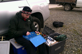
And here is Sam working out the gear while they wait for the helicopter to take them to Wednesday peak.
Another thing that earthquakes have done recently, is teach us places in New Zealand that we haven't heard of before! The team were kind enough to stop and take a photo of the Tuatapere sign for me!
 |
I first heard of the town Tuatapere back in 2009 after the Dusky Sound earthquake where the location came through as "100 km north-west of Tuatapere" and left a few of us wondering where on earth is that ( i remember texting Lara)!! A few years down the track and a few more shakes off the South Island have made the town quite well known.
They drove through Nightcaps and Ohai to get there too.


Cheers for posting! Always good to see the local spots featured online :)
ReplyDelete