Thursday, April 4, 2013

Playing Possum on Tongariro

With our monitoring of the active volcanoes in New Zealand, we have cameras on them so we can view the latest activity and sneaky night-time eruptions.You can see these cameras along with the latest information on the volcanoes here

Now i posted a while ago about about some of the funny things we see on our volcano cameras (here)  but i received an email today from Dawn (thanks for the great spotting!) of an interesting visitor to the Te Mari crater camera on the 29th of March at 11:10PM, she thought it was a cat, but i'm thinking it looks more like a possum!


Hopefully one day we will see one of those elusive Kaimanawa horses.

Wednesday, February 27, 2013

Tremors?


No not those!

One of the fun things you learn in school is that you can have 1 cat or 2 cats,  but sheep is sheep no matter how many there are!

The same goes for a word we use often with our volcanoes - tremor. The media (who probably think we can't spell) often change our information, and publish 'tremors' but it actually doesn't have an s at all!


So what is volcanic tremor??

Volcanic tremor on White Island last year
Its a continuous or semi-continuous ground vibration produced by degassing, underground boiling, magma movement, ash eruptions and a range of other sources.

It often looks like wind noise on our drums ->


Tuesday, February 19, 2013

Exploring Vanuatu


Vanuatu has some of the most active, and potentially dangerous, volcanoes in the southwest Pacific. Over the last 50 years, many communities have been affected by volcanic ash fall, gas and acid rain, lava flows and lahars.

So (naturally) last week i went there for a tropical holiday!

First is a wee bit of info on the volcanoes and our (GNS Science & GeoNet's) relationship with Vanuatu....


In 2012 a five-year New Zealand-funded project to increase the resilience of Vanuatu to volcanic eruptions begun, funded by the government's New Zealand Aid Programme. This built on co-operation between the two countries over past eruptions on  Ambae Volcano and Gaua Volcano and has introduced real-time seismic and camera monitoring of three Vanuatu volcanoes (Tanna, Ambae, and Gaua) for the first time, allowing time for emergency procedures to be put in place. It also aims to enhance community preparedness through a comprehensive outreach and education programme, and develop robust protocols and procedures for responding to a volcanic emergency.

Data from the volcanoes is transmitted back to the Vanuatu Meteorology and Geohazards Department (VMGD) in Port Vila. where technicians will be able to monitor and provide timely warnings to the communities on the islands. Volcano experts from our team up in Wairakei have helped train these technicians in the skills needed for installing and maintaining the new instruments, so the benefits of the project will be sustainable.Head of the Volcanology Department at GNS Science, Gill Jolly, has also spent  time working closely with scientists in Vanuatu to develop procedures for triggering warnings of volcanic activity in the islands.

Now for the fun part! 


I spent last week in sunny Vanuatu and had an amazing time exploring and snorkeling! We were based in Port Vila, the capital of Vanuatu, which is on the island of Efate.


On my last day there i went for a day trip to the island Tanna, which is an hour south (on a small plane) and is home to the volcano Mt Yasur. 


Looking over to Mt Yasur


And after 90-bumpy-minutes by 4WD you are at the base of the volcano, it is surrounded by a huge ash plane which looked awesome (and was quite fun in the 4WD)


The ash planes


We then picked up a guide and did some more 'extreme' 4wheeldriving to get up near the top of the volcano and then its a 15min walk up to the top of the crater.


Thats our guide - with bare feet .....


The view was amazing and the sounds that the volcano makes are impressive! Every 5min or so you would hear a large boom and see huge 'lava bombs' thrown up into the air and thump back down onto the crater wall.


Heading up to the top of the crater


We left with big grins and a covered in a fair amount of ash! A fantastic (and slightly scary) experience!


And there it is!


Here is a small video i made, naturally i missed all of the 'good stuff' but you can still see how powerful this volcano is - especially when its in a 'normal / quiet' state!


You can see the cameras and latest activity on the volcanoes here and read more on Tanna here

And here are some token touristy / fish photos!


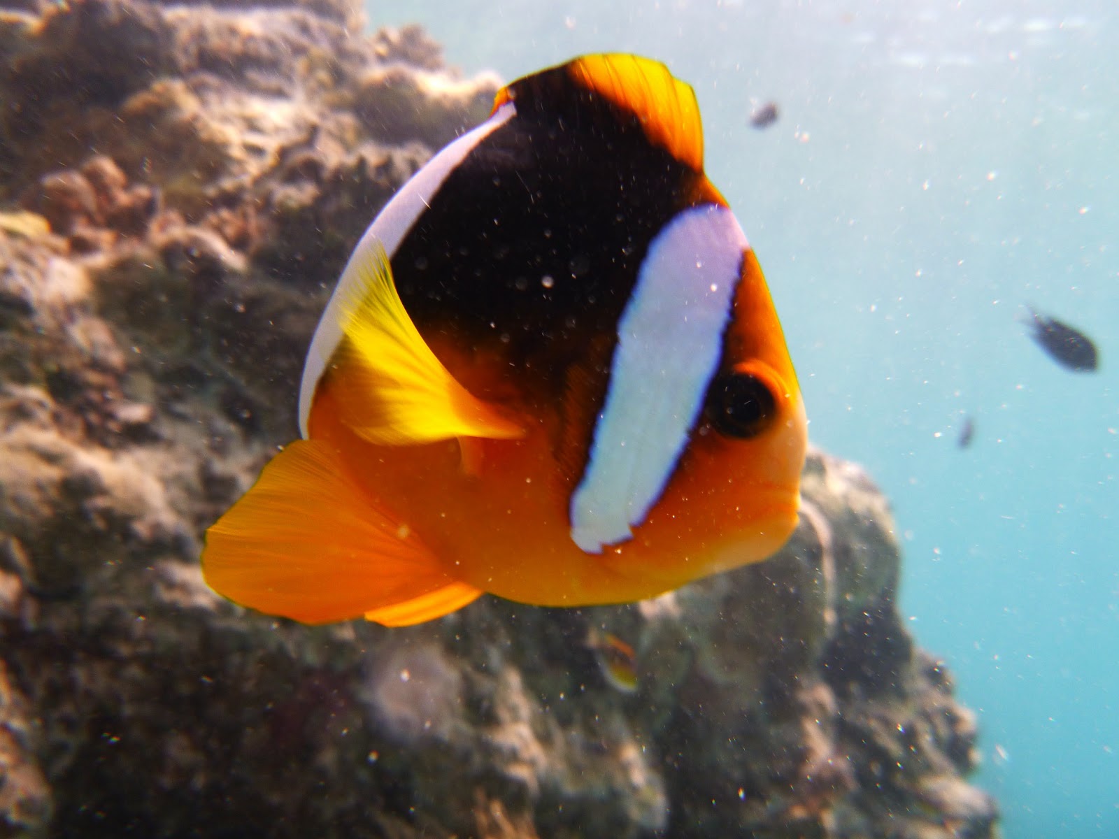
This is a 'cousin' of Nemo - he doesn't look too happy that i found him


Thursday, January 17, 2013

Its 2013 - Time to get back out in the field


This week Lara (GeoNet Network Operations and Development Manager) and i came down to Canterbury to collect four temporary seismic sites from Mt Hutt Station, and scope around for new test areas for permanent sites.  We aim to put out 5/6 sites to test for two different potential stations, this depends on time/weather etc.


After the Canterbury earthquakes we expanded our seismic network in the immediate area, so these sites are a continuation of that and they will be the southern most new additions for the Canterbury extension.

Below are some are some photos from our trip for your viewing pleasure! You can read one of my more detailed blogs on how we set up our test sites here

Day One: Mt Hutt


Loading up the ute in Christchurch


Mt Hutt Station


Our first site to collect at Mt Hutt Station


 Day two: Arundel  <- click to find out where this is (and no,  its not Middle Earth)


Lara digging at our First site

All finished!


Second site finished with a thunderstorm in the background

The cows were really keen

And then the storm got us

Hail = ouch!

Murphy the farmers dog didn't like the thunder and caught a ride home with us


Tomorrow we are out and about in Timaru - fingers crossed for nice weather!

Friday, December 21, 2012

The End is Nigh...

And many people are beginning to wind down for the year, and some have finished already.

Although many of us will be out of the office, GeoNet is 24/7 so we will have people monitoring earthquakes, volcanoes and landslides etc throughout the holidays. Social media will also be taken care of as some of us *cough* can't stay off our phones!

So although we have fingers and toes crossed for a geologically/hazardy uneventful holiday break, if anything does decide to play up don't worry, we will be onto it.

All news and Volcano Alert Bulletins etc. will still be posted here

And if you ever have trouble finding any news stories, or data try the search box (see -->)


So HAPPY HOLIDAYS! (And here is a little festive Simons Cat for your Friday amusement)


Wednesday, November 21, 2012

Volcanoes, Eruptions, Oh My!

Well the second half of 2012 has been all about the volcanoes! Tongariro and White Island in August then maybe Ruapehu, but no Tongariro again!

So firstly some important information on what to do during during an ash fall event and lava flows and general information for before/during/after an eruption from CDEM.

Where to find information on our website:

Current status of the volcanoes, drums and cameras here
News and Volcanic Alert Buletins here
More information and history on Tongariro here and our other volcanoes here

What do the alerts mean?


So what does this mean?

Unfortunately we don't know what will happen in the days to come. As far as eruptions go this was just a small one, only lasting five minutes. And there were no signs that Tongariro was going to erupt again today, volcanoes can be sneaky like that!

We do have lots of seismic sensors on and around the volcanoes and cameras watching the mountains as well as a great team of experts currently looking at all of the data coming in! So we will be closely monitoring the volcanoes and putting out bulletins as more information comes in.

View from Te Maari Crater shortly after the eruption.


Friday, November 2, 2012

Lots of earthquakes - What does this mean?

Another comment we often see is "there have been xx earthquakes today, what does this mean"

We it means that we are living in a really interesting place! New Zealand is located on the boundary of two of the world’s major tectonic plates – the Pacific Plate and the Australian Plate. Below is a video explaining how this plate boundary creates earthquakes in NZ.


Another thing to remember with our new website is that we are showing you all of the earthquakes that we locate, the old website just had the larger/felt events.  And we locate over 20,000 earthquakes a year!

As you can see in the picture below, the earthquakes occur along the plate boundary in both the North and South Islands. The shallow earthquakes (under 40km deep) occur across quite a wide area (pink - red dots) while the deeper quakes (below 40km deep) occur on the sloping surface that shows where the plate boundary dips down at an angle (orange - yellow - blue dots)

All located earthquakes in 2011 (24,000) via QuakeSearch


Another cool thing you can see on our new website is a summary of earthquakes in the New Zealand region  here

You can see that as of this morning, we have had 168 earthquakes of mag 2-3 in the last week.


So lots of earthquakes in one area....

Can mean you are having a swarm = a swarm is a sequences of many earthquakes, usually in a short time period (hours to days). These occur all the time in NZ, with Taupo, Rotorua, Matata and Te Aroha being popular locations! 

They are normal processes and can be related to the long term tectonic stretching of the crust that occurs in the central North Island.


More info:

Stats on earthquakes from 1960

 
Neat Diagram of the plates in NZ

Video of the tectonic evolution of NZ

Historical Earthquakes in NZ